
Sheepshead Bay & Madison Flood Exposure · NYC DEP Separate Storm Sewer Area
Sheepshead Bay & Madison, Brooklyn - MS4 Area
Properties here drain through separate storm sewers: rain runs in its own pipes straight to Sheepshead Bay and Gerritsen Creek, apart from the sewage. When a storm drops rain faster than the catch basins can take it in, the water collects on streets and low lots instead. Here’s what that looks like for Sheepshead Bay & Madison, Brooklyn specifically.
19,430 properties in Sheepshead Bay & Madison, Brooklyn drain through separate storm sewers to Sheepshead Bay and Gerritsen Creek. Flood Form rates 57% of them Moderate or High for stormwater, 20% for sewer backup, 60% for groundwater, and 55% for coastal flooding. 77% of lots have yard area that legally qualifies for on-site infiltration. The ground is fairly level here, typically about 11 ft. The median building dates to 1930. 7% of parcels sit over a historic stream or pond. Their runoff reaches the water through 41 NYC DEP storm sewer outfalls.
See where your property stands
Free. Takes about 60 seconds.
Flood exposure in Sheepshead Bay & Madison (Sheepshead Bay & Gerritsen Creek)
The share of properties Flood Form rates Moderate or High for each type of flooding, on the same Minimal to High scale as an individual report.
57%
Stormwater exposure: Moderate or High
20%
Sewer Backup exposure: Moderate or High
60%
Groundwater exposure: Moderate or High
55%
Coastal exposure: Moderate or High
What sets Sheepshead Bay & Madison (Sheepshead Bay & Gerritsen Creek) apart
The three figures on which this area differs most from the rest of NYC’s separate storm sewer areas.
1930
Median year built
Older than 95% of NYC's separate storm sewer areas. Buildings of this age tend to have aging drains and sewer connections.
76.8%
Legally eligible for on-site infiltration
Lower than 95% of NYC's separate storm sewer areas. Few yards can legally infiltrate, so holding runoff matters more.
57%
Properties with Moderate or High stormwater exposure
Higher than 90% of NYC's separate storm sewer areas. Heavy rain ponds on or flows across more lots here.
Stats computed from Flood Form’s NYC parcel data as of October 28, 2026
Where Sheepshead Bay & Madison’s storm sewers drain
The waters NYC DEP maps this area’s storm sewer outfalls to, by number of properties.
16,312
Sheepshead Bay
2,533
Shell Bank Creek
322
Plum Beach Channel
263
Gerritsen Creek and Tidal Tributaries
Common solutions for Sheepshead Bay & Madison properties
The measures that most often suit conditions here. An individual Flood Form picks the exact set for one lot. See all flood prevention solutions.
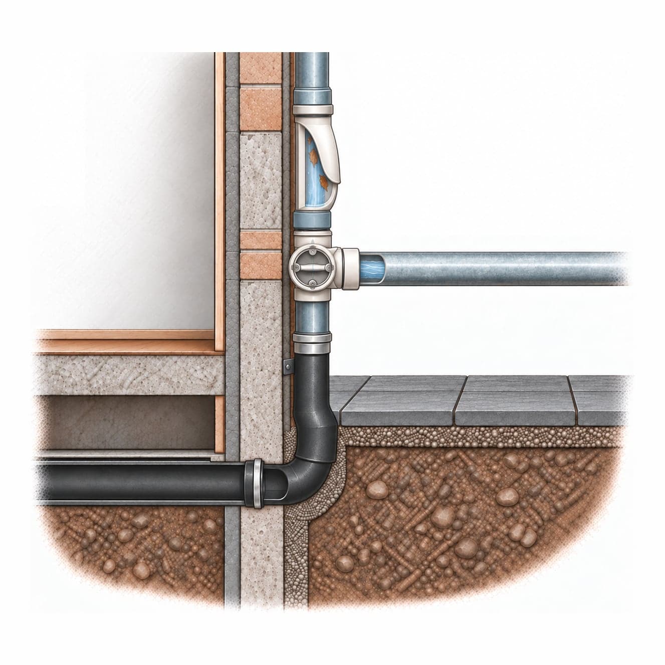
Downspout Diversion
Redirect roof downspouts away from the sewer system toward permeable yard areas, planters, or a rain barrel.
Complexity: Low · 1–4 weeks
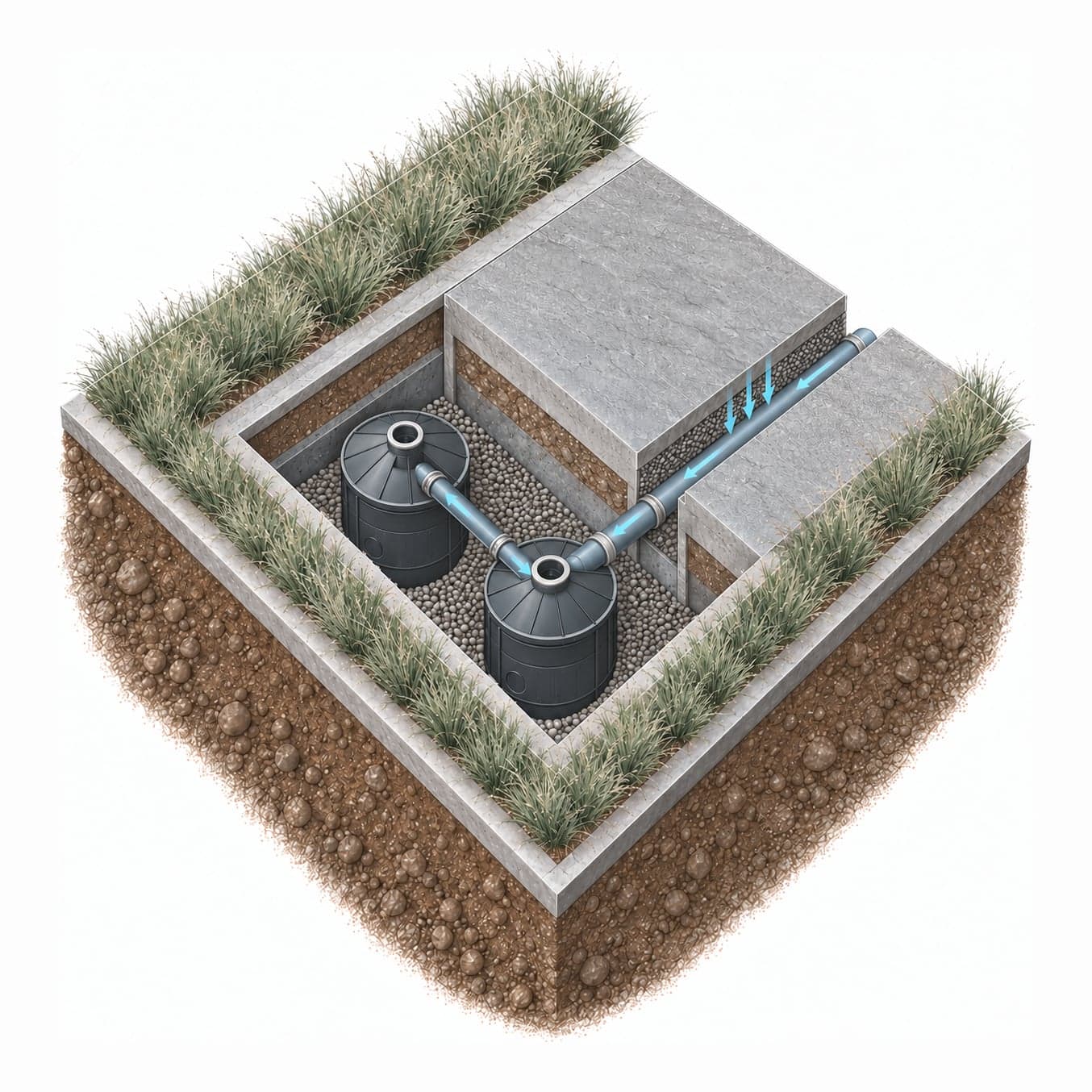
Modular Drywell System
An NDS Flo-Well modular drywell system lets water soak into the ground on-site.
Complexity: Moderate · 1–3 weeks
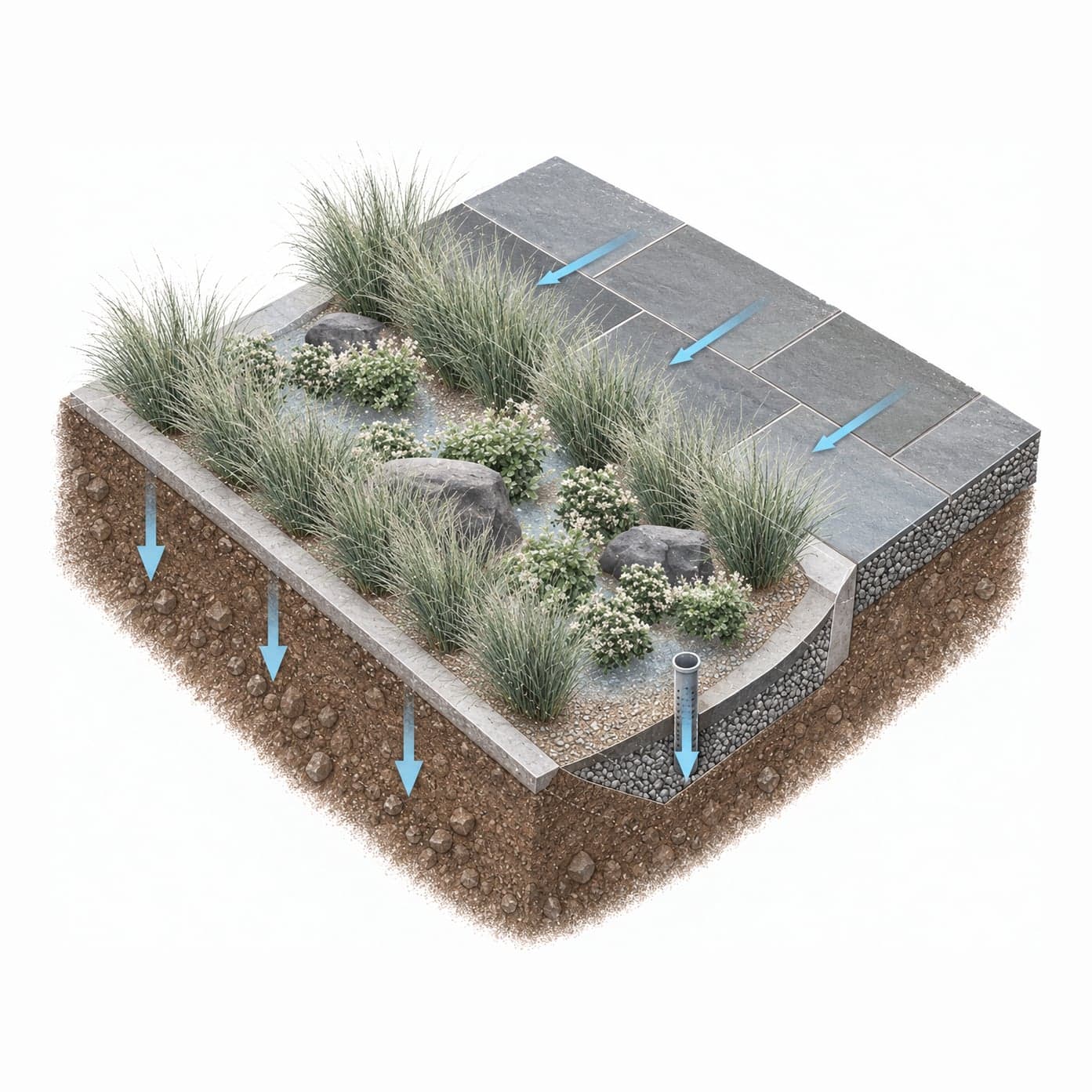
Rain Garden
A shallow planted depression that collects runoff from roofs and paved areas and lets it soak into the ground over a day or two.
Complexity: Low · 1–3 weeks
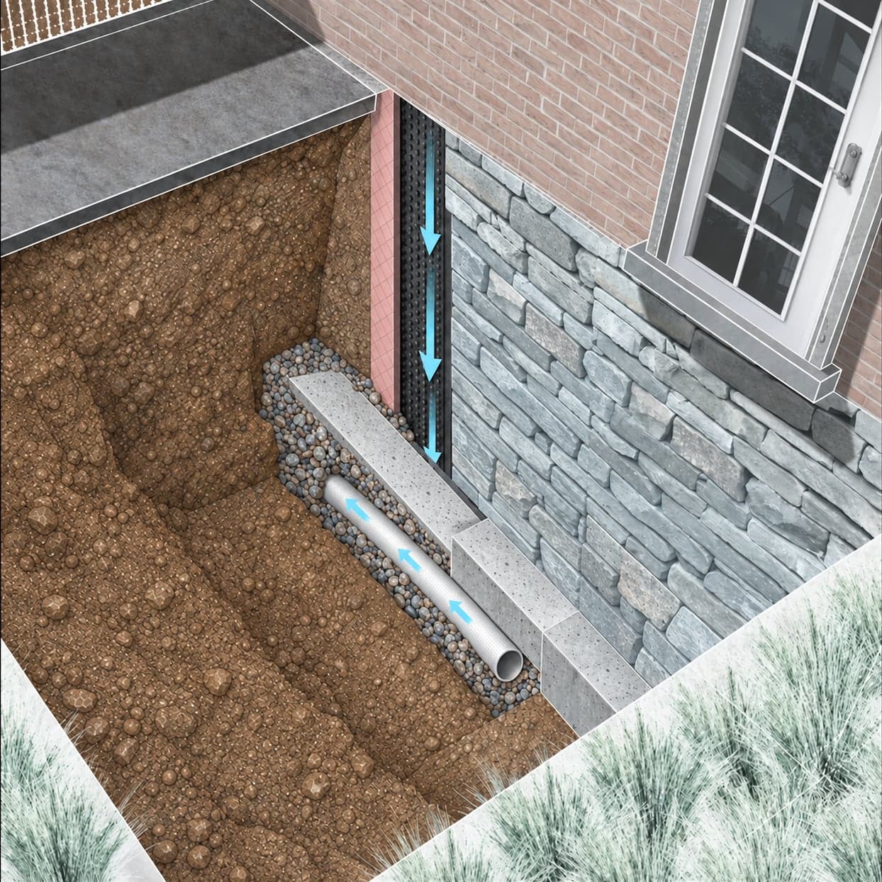
Foundation Waterproofing
Exterior membrane waterproofing, interior footing drains, or crystalline waterproofing compounds address hydrostatic pressure against the foundation, depending on construction type.
Complexity: High · 3–6 months
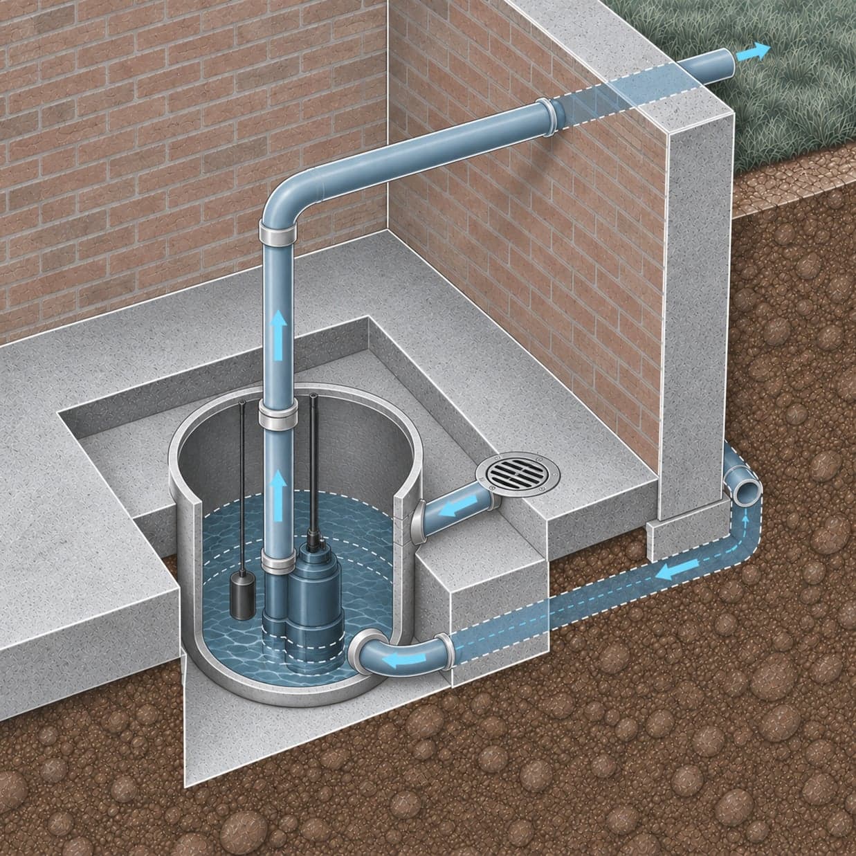
Sump Pump
A sump pump with battery backup actively removes water that accumulates in below-grade spaces during groundwater rise or sewer surcharge events.
Complexity: Low · 1–4 weeks
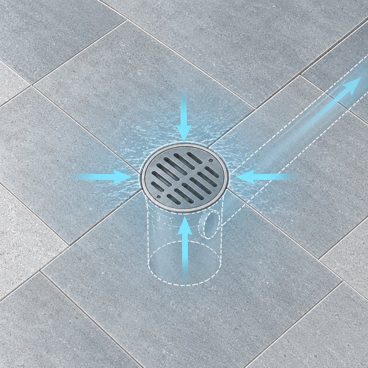
Area Drain
A yard area drain — a surface inlet at the lowest point in the yard — provides a direct outlet for stormwater that pools on the site.
Complexity: Low · 1–4 weeks
Which of these fit your lot?
Your Flood Form rates your property’s exposure and recommends the measures suited to it.
Free. Takes about 60 seconds.
Questions about flooding in Sheepshead Bay & Madison (Sheepshead Bay & Gerritsen Creek)
What does it mean that Sheepshead Bay & Madison has separate storm sewers?
This part of Sheepshead Bay & Madison, Brooklyn is served by a separate storm sewer system, which NYC DEP calls an MS4. Catch basins and roof drains carry rain in their own pipes straight to Sheepshead Bay and Gerritsen Creek, while wastewater flows in another pipe to a treatment plant. Because rain doesn't share a pipe with sewage here, a storm is less likely to push sewage back into basements than in combined-sewer neighborhoods, though a blocked or undersized house sewer line can still back up. Flooding here mostly comes from runoff the storm drains can't take in fast enough, and from groundwater and tides.
How exposed to flooding is Sheepshead Bay & Madison (Sheepshead Bay & Gerritsen Creek)?
The most widespread exposure in Sheepshead Bay & Madison is groundwater: Flood Form rates 60% of properties Moderate or High for it. The share is 57% for stormwater, 20% for sewer backup and 55% for coastal flooding. These figures describe the whole area, and exposure varies lot by lot within it.
Can properties in Sheepshead Bay & Madison (Sheepshead Bay & Gerritsen Creek) manage stormwater on site?
77% of lots in Sheepshead Bay & Madison have yard area that legally qualifies for on-site infiltration, such as a drywell or rain garden. A lot without that room can still hold runoff with a detention tank or a blue roof.
Why does runoff from Sheepshead Bay & Madison matter for Sheepshead Bay and Gerritsen Creek?
Storm sewers here discharge runoff without treatment, so what washes off streets, roofs and yards ends up in Sheepshead Bay and Gerritsen Creek. Holding roof runoff on site with a rain garden, drywell, or detention tank cuts flooding on the property and what reaches the water.
How do I check one property in Sheepshead Bay & Madison (Sheepshead Bay & Gerritsen Creek)?
Enter the address on this page to get its free Flood Form. The report rates that property for stormwater, sewer backup, groundwater, and coastal flooding, and recommends measures suited to the lot.
Nearby separate storm sewer areas
- Mill BasinMarine Park & Mill Basin10,396 properties · 56% with Moderate or High stormwater exposure
- Coney Island Creek & Gravesend BayConey Island & Gravesend7,412 properties · 62% with Moderate or High stormwater exposure
- Paerdegat BasinCanarsie & Bergen Beach3,164 properties · 57% with Moderate or High stormwater exposure
- Fresh Creek & Hendrix CreekEast Canarsie & Starrett City5,116 properties · 48% with Moderate or High stormwater exposure
- Shellbank & Hawtree BasinsHoward Beach5,067 properties · 52% with Moderate or High stormwater exposure
- Jamaica Bay & Rockaway InletThe Rockaways11,447 properties · 45% with Moderate or High stormwater exposure