
Is Sugar Hill flooding right now?
Checking live flood alerts and sewer overflow conditions…
Sugar Hill Flood Exposure · NYC DEP Combined Sewer Area NR-002
Sugar Hill, Manhattan - NR-002
Properties in this area share the NR-002 combined sewer — during moderate-to-heavy rain, runoff can exceed pipe capacity faster than it drains, which is what drives sewer backup exposure block by block. Here’s what that looks like for Sugar Hill, Manhattan specifically.
NR-002 is a combined sewer area covering 156 properties in Sugar Hill, Manhattan. Flood Form rates 38% of them Moderate or High for stormwater, 4% for sewer backup, and 3% for coastal flooding. None rate that high for groundwater. 78% of lots have yard area that legally qualifies for on-site infiltration. The ground slopes gently down toward the north, from about 111 ft to 71 ft, so runoff from higher blocks drains toward lower ones. The median building dates to 1912. 50% of parcels sit over a historic stream or pond. NYC DEP models about 38 combined sewer overflows a year at its outfall.
See where your property stands
Flood exposure in Sugar Hill (NR-002)
The share of properties Flood Form rates Moderate or High for each type of flooding, on the same Minimal to High scale as an individual report.
38%
Stormwater exposure: Moderate or High
4%
Sewer Backup exposure: Moderate or High
0%
Groundwater exposure: Moderate or High
3%
Coastal exposure: Moderate or High
What sets Sugar Hill (NR-002) apart
The three figures on which NR-002 differs most from the rest of NYC’s combined sewer areas.
50%
Properties over a historic stream or pond
Higher than 95% of NYC's combined sewer areas. Buried waterways still steer groundwater under these blocks.
4%
Properties with Moderate or High sewer backup exposure
Lower than 92% of NYC's combined sewer areas. Few lots have the records or basements that point to backups.
87 ft
Median ground elevation
Higher than 93% of NYC's combined sewer areas. High ground, where runoff drains away downhill.
Stats computed from Flood Form’s NYC parcel data as of October 14, 2026
The worst corner in Sugar Hill
A corner on Broadway
Of the 3 four-way intersections Flood Form compared in NR-002, the 38 lots within 100 meters of this one carry the highest average compound flood exposure: a score of 6.2, against 4.4 across the sewershed.
Moderate
Compound exposure
Moderate
Stormwater exposure
Low
Sewer Backup exposure
Low
Groundwater exposure
Minimal
Coastal exposure
Ratings are for the average lot near the corner, on the same Minimal to High scale as a report
Common solutions for Sugar Hill properties
The measures that most often suit conditions in NR-002. An individual Flood Form picks the exact set for one lot. See all flood prevention solutions.
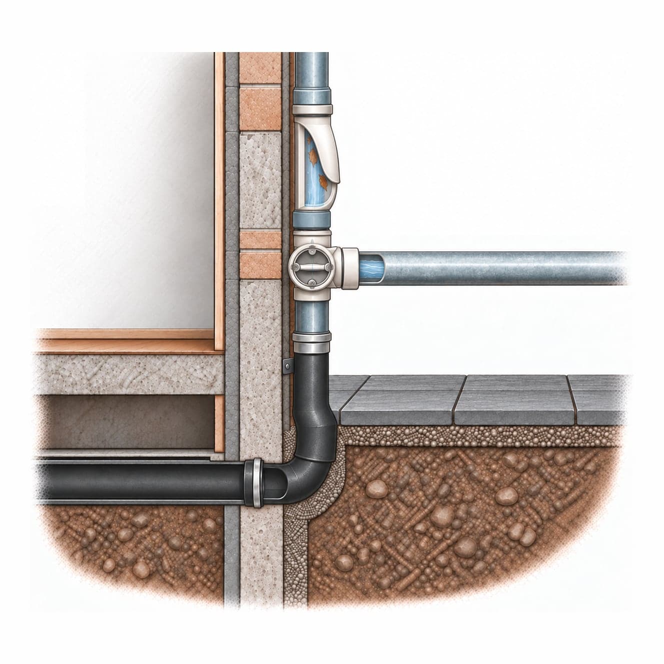
Downspout Diversion
Redirect roof downspouts away from the sewer system toward permeable yard areas, planters, or a rain barrel.
Complexity: Low · 1–4 weeks
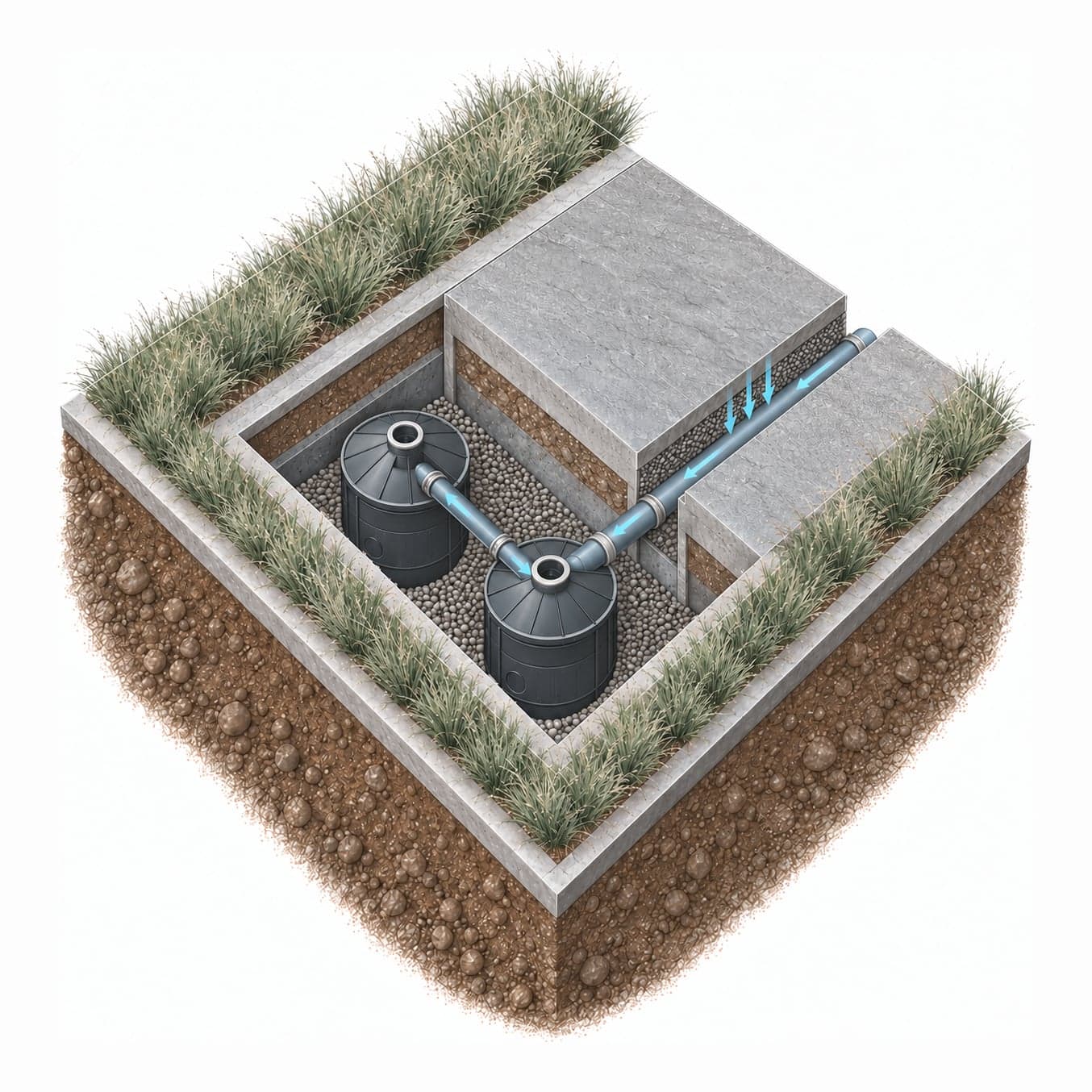
Modular Drywell System
An NDS Flo-Well modular drywell system lets water soak into the ground on-site.
Complexity: Moderate · 1–3 weeks
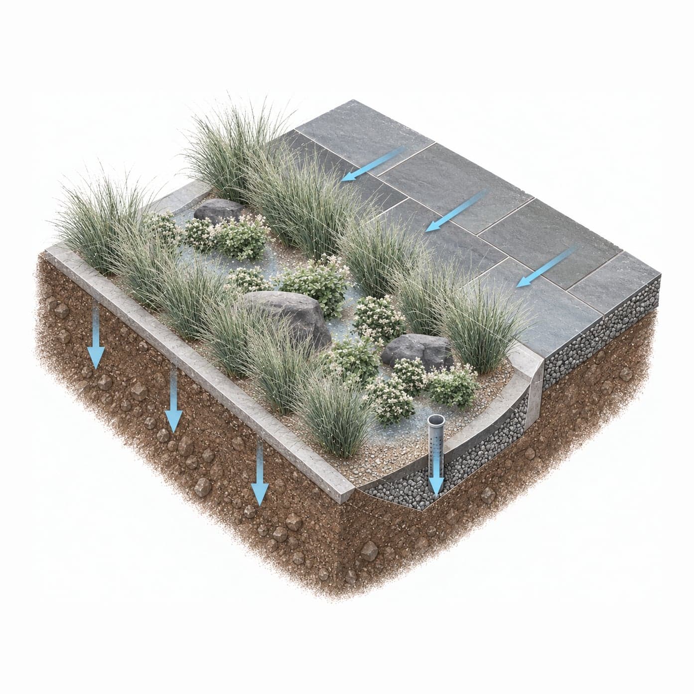
Rain Garden
A shallow planted depression that collects runoff from roofs and paved areas and lets it soak into the ground over a day or two.
Complexity: Low · 1–3 weeks
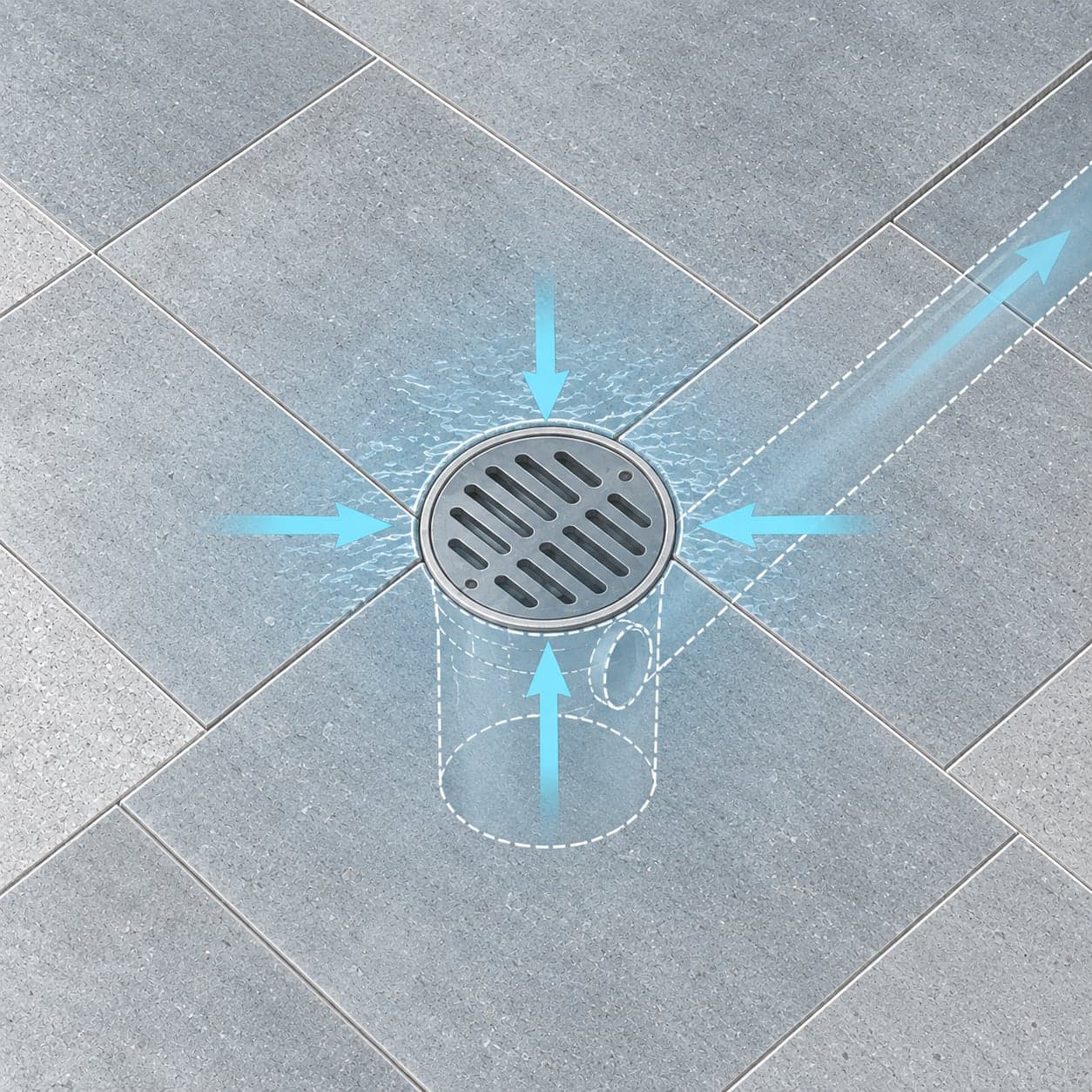
Area Drain
A yard area drain — a surface inlet at the lowest point in the yard — provides a direct outlet for stormwater that pools on the site.
Complexity: Low · 1–4 weeks
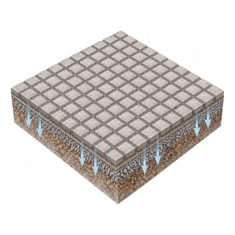
Increase Permeable Area
On-site interventions include permeable paving for driveways and walkways, removing concrete from yard areas, and adding planted beds — reducing impervious coverage that limits the neighborhood's collective capacity to absorb rain.
Complexity: Low · Ongoing
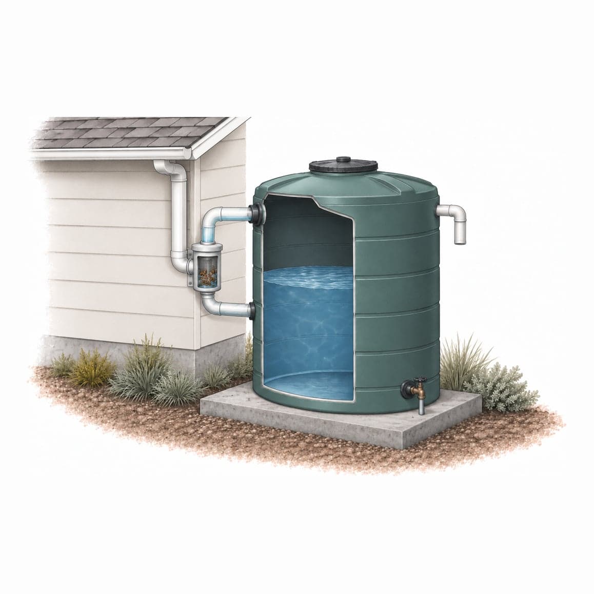
Detention System
A detention cistern or underground storage tank temporarily holds stormwater runoff and releases it slowly after storm peaks subside.
Complexity: High · 3–6 months
Which of these fit your lot?
Your Flood Form rates your property’s exposure and recommends the measures suited to it.
Questions about flooding in Sugar Hill (NR-002)
What is the NR-002 sewershed in Sugar Hill?
NR-002 is the part of Sugar Hill, Manhattan whose combined sewer leads to NYC DEP outfall NR-002. Its 156 properties share that pipe for both rain and wastewater, so a heavy storm anywhere in the area uses up capacity for every block in it.
Which Sugar Hill sewershed has the most sewer backups?
Sugar Hill is split across two sewersheds. NR-002 has the most sewer backup reports of the two: 115 in every 1,000 lots over the last 10 years. NR-056 has 73. This page covers NR-002, and its map outlines the blocks it includes.
Do properties in Sugar Hill (NR-002) report sewer backups?
Over the last 10 years, 115 in every 1,000 lots in NR-002 filed a 311 sewer backup report, against a median of 75 across NYC's combined sewer areas. NYC DEP has not confirmed a problem in the city sewer behind any of them.
How exposed to flooding is Sugar Hill (NR-002)?
The most widespread exposure in NR-002 is stormwater: Flood Form rates 38% of properties Moderate or High for it. The share is 4% for sewer backup and 3% for coastal flooding. These figures describe the whole area, and exposure varies lot by lot within it.
Is Sugar Hill flooding right now?
The live check at the top of this page shows whether flooding is likely in Sugar Hill now. It combines National Weather Service flood alerts for Manhattan, NYC DEP's modeled combined sewer overflow advisories, and the past three hours of rain. Most NYC sewers are designed for about 1.75 inches of rain an hour, so a heavy downpour can flood streets and basements on low blocks before any alert goes out. Report street flooding or a sewer backup to 311, and call 911 if anyone is in danger.
Nearby neighborhoods and sewersheds
- NR-056Sugar Hill588 properties · 18% with Moderate or High stormwater exposure
- NR-003Washington Heights403 properties · 30% with Moderate or High stormwater exposure
- WI-046Harlem1,534 properties · 35% with Moderate or High stormwater exposure
- WI-051Washington Heights258 properties · 36% with Moderate or High stormwater exposure
- WI-045Harlem528 properties · 25% with Moderate or High stormwater exposure
- WI-064Concourse213 properties · 43% with Moderate or High stormwater exposure