
2026 Stormwater-Year-in-Review
WHAT NYC’S 2026 STORMS HAVE TO TEACH US ABOUT DRAINAGE AND STORMWATER MANAGEMENT
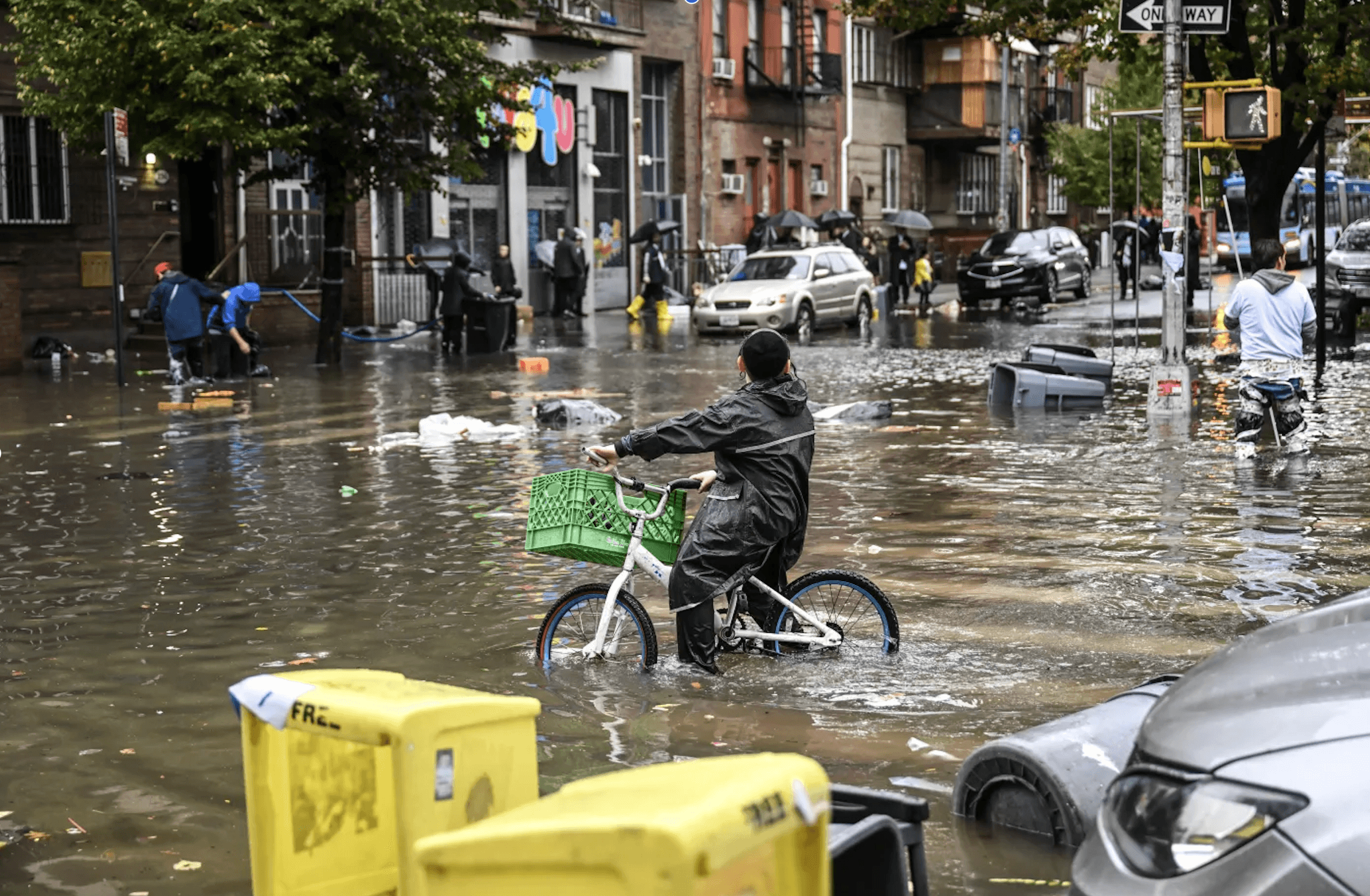
This year, New Yorkers have experienced intense rainfall over and over, neighborhood by neighborhood.
The storms of 2026 have repeatedly demonstrated how localized NYC’s flooding can be. From intense spring thunderstorms to summer downpours to September’s coastal flooding, this year’s rain and flood events reinforce the importance of understanding how water moves through each neighborhood, block, and property.
New York City’s flooding problem begins with a growing mismatch: intense rainfall can deliver water faster than our outdated sewer infrastructure, streets, and soil can carry it away or absorb it. The storms of 2026 offer several examples of this mismatch – which is particularly striking when understood in the context of a long-term trend toward heavier precipitation.
Heavier precipitation is becoming more frequent and intense across much of the country, particularly in the Northeast.
Across the Northeast, the amount of precipitation falling on the heaviest 1% of days increased by approximately 60% between 1958 and 2021, according to the Fifth National Climate Assessment.
That figure describes precipitation concentrated in the wettest days, rather than a 60% increase in annual rainfall. It is a consequential distinction for a city whose drainage system must respond not just to total volume, but to how quickly water arrives.
New York City’s own climate assessments also document increasing annual precipitation across its long-term weather stations since 1959, although the strength of that trend varies by station. Looking ahead, the New York City Panel on Climate Change projects average annual precipitation increases of approximately 4–11% by the 2050s, relative to the 1981–2010 baseline.
May 20, 2026
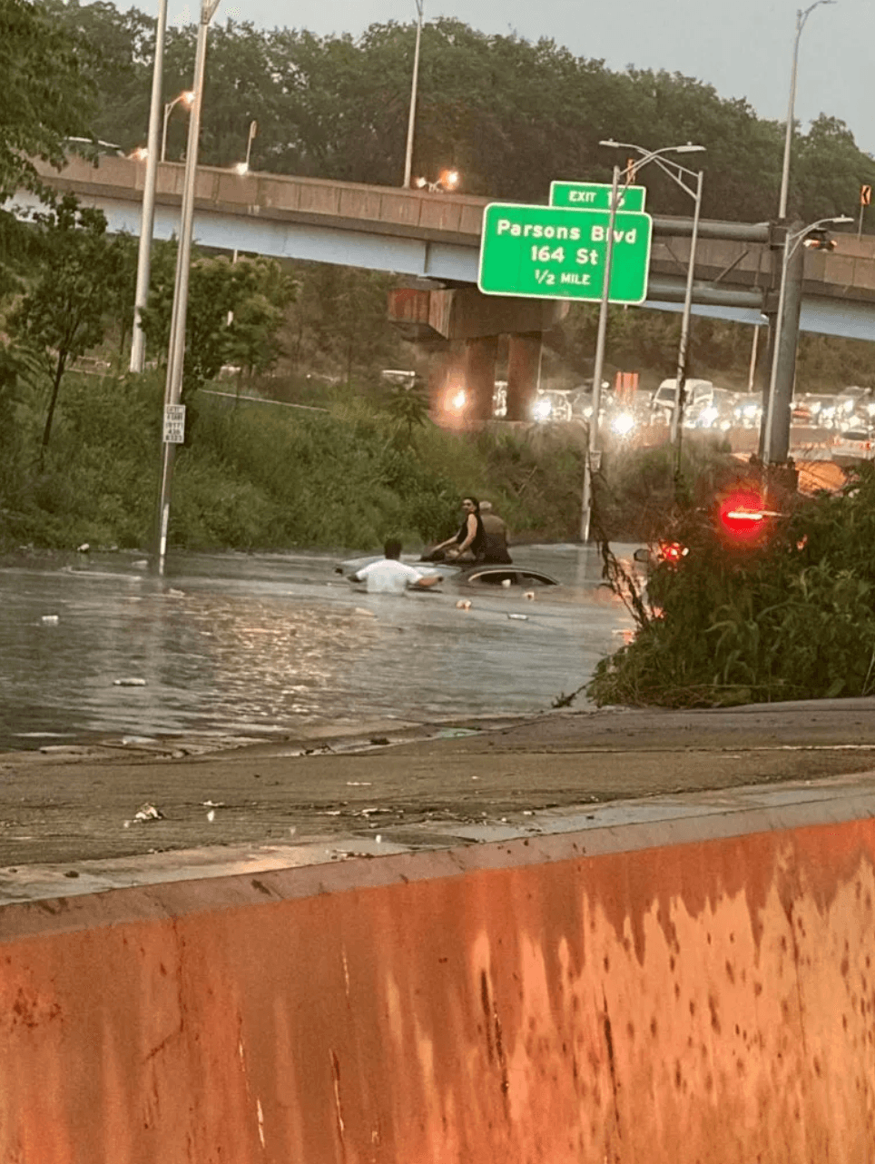
On May 20, thunderstorms delivered 1.5–2 inches of rain in an hour to parts of Brooklyn and Queens. Flash flooding closed sections of major Queens highways, including the Long Island and Clearview expressways and Cross Island Parkway. A brief storm was enough to cause substantial disruption.
July 5-6, 2026
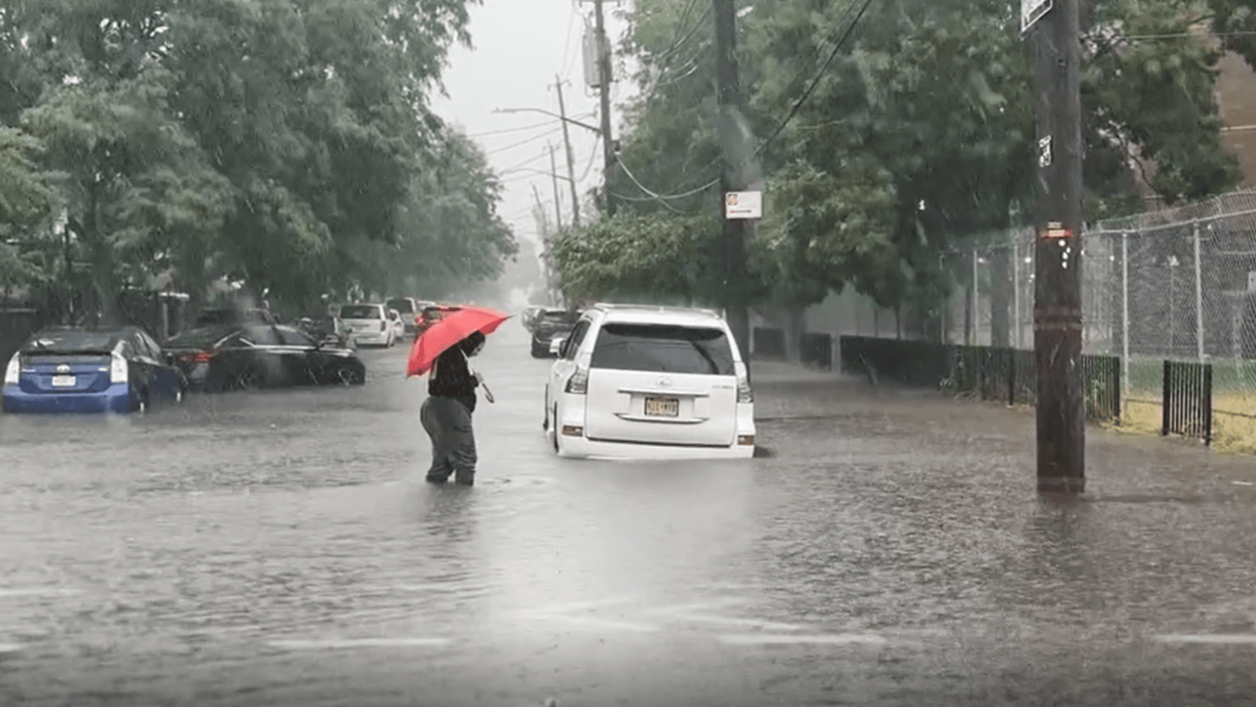
On July 5 and 6, coastal Brooklyn and Queens received 4–6 inches of rain, while much of the NYC metro area received approximately 1–2 inches. The National Weather Service documented localized flash flooding near Coney Island. The same weather system produced very different conditions across the city.
August 20, 2026
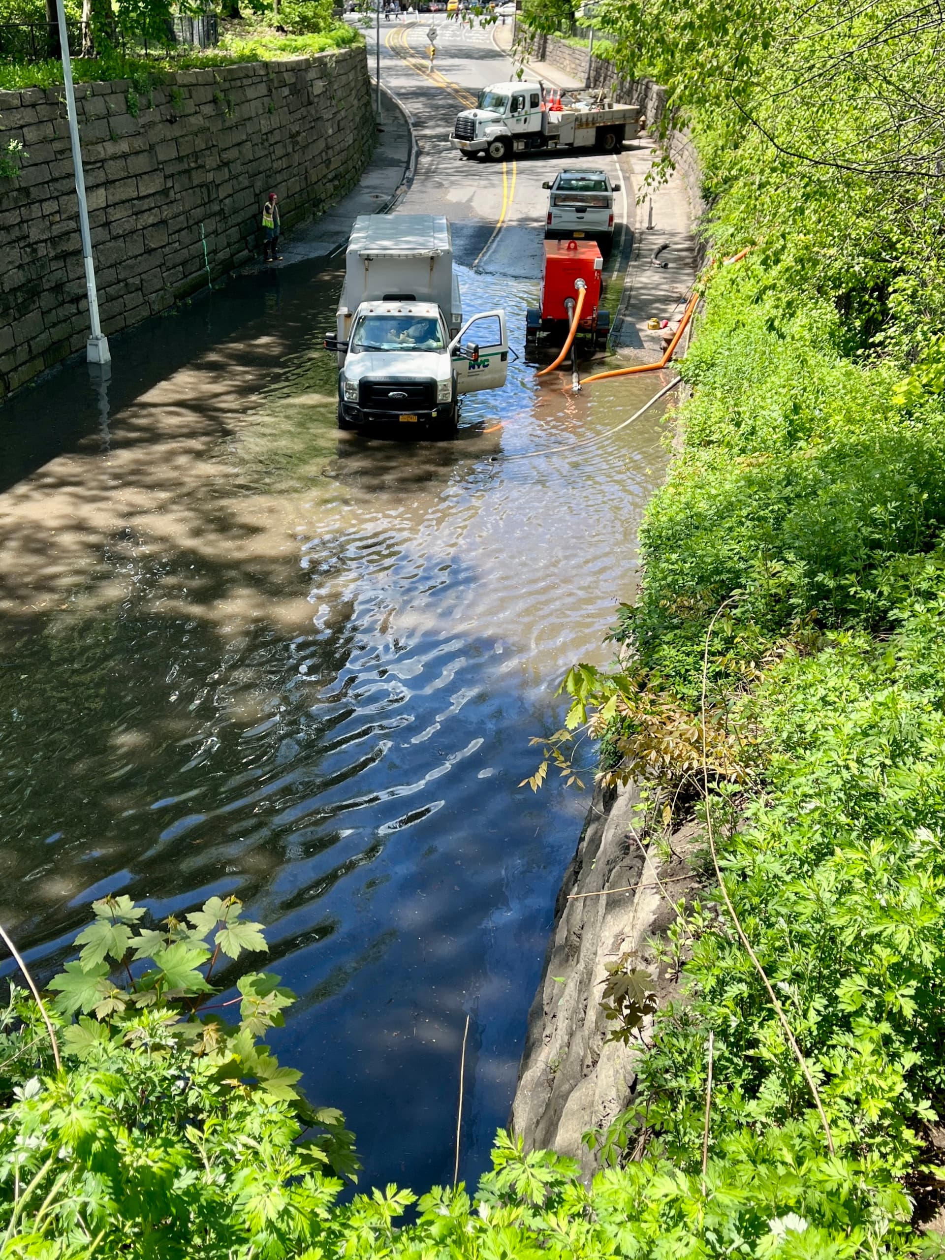
On August 20, Central Park recorded 1.82 inches in just one hour, during a storm that brought flash flooding across the NYC metro area. That measurement captures something a seasonal rainfall total cannot: how quickly water can arrive.
September 26-27, 2026
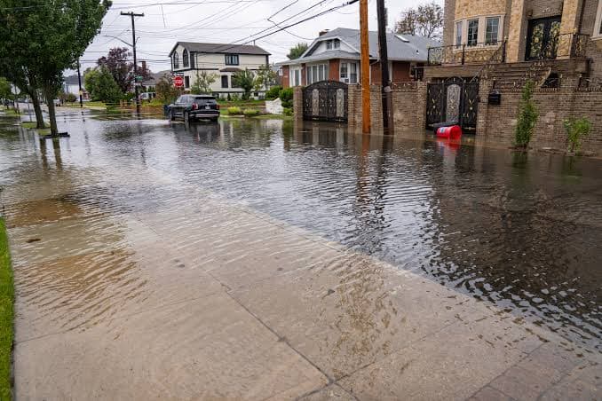
In late September, a powerful nor’easter brought heavy rain, strong winds, and coastal inundation, including flooding in coastal Queens. It added a different source of exposure: water pushed inland from the coast.
What happens to the water when it reaches your property?
For FloodForm, this question is the starting point.
We look at where water comes from, how it travels, where it collects, and how it can enter a building. Rainfall intensity is just one part of the picture. Roof runoff, surrounding pavement, elevation changes, drainage connections, and conditions on neighboring properties help determine what happens next.
OUR APPROACH
We identify opportunities to capture, slow, store, or infiltrate stormwater where conditions allow, alongside measures that protect vulnerable building openings and address drainage problems. The appropriate combination depends on the site and the source of flooding.
THE STORMWATER RESILIENT DISTRICT
This work also extends beyond individual property lines; roofs, backyards, sidewalks, and streets are all connected by the movement of water.
FloodForm’s proposed Stormwater Resilient Districts offer a structure for understanding this shared exposure, organizing property owners, and coordinating improvements across lots, blocks and neighborhoods. Individual projects become part of a larger effort to manage water where it falls and along the paths it follows.
City infrastructure (alone) can’t handle the truth
NYC’s published sewer design criteria use 1.75 inches of rainfall in one hour as a benchmark for sizing pipes. That is a design reference, not a guarantee that every block can drain that amount without flooding. Local capacity depends on the drainage network, contributing runoff, and conditions at the site.
When runoff exceeds pipe capacity, water can accumulate on streets and enter vulnerable properties. In coastal areas, high tides and storm surge can also push water back through the drainage system. The Department of Environmental Protection (DEP) identifies both stormwater runoff and coastal surges as causes of flooding in New York City.
EXISTING CONDITIONS
Approximately 60% of NYC has a combined sewer system, where stormwater and sewage travel through the same pipes. Heavy rain can overwhelm that system with combined sewer overflows discharging a mixture of runoff and untreated sewage into local waterways. Street flooding, building backups, and waterway pollution are different consequences of pressure on the drainage system; they do not necessarily occur together at every location, but they can all cause significant damage.
This is why adapting to heavier rainfall requires work both below and above ground. Sewer improvements remain essential. So do measures that reduce and delay the runoff entering those sewers. NYC’s cloudburst approach combines pipes and underground storage with trees, rain gardens, and other features that absorb, store, and manage stormwater.
FloodForm is part of the answer to this citywide challenge
At Flood Form, we see the role of individual properties and neighborhoods as critical to advancing the city’s overall flood resilience.
When we understand where water comes from, where it collects, and how it enters a building, we can idenntify appropriate opportunities for storage, infiltration, controlled release, drainage improvements, and building protection – all of which helps reduce a given property’s exposure while managing its contribution to the surrounding drainage system.
Reflecting on a very wet year
The lesson we draw from 2026 is that resilience starts at the source – where the water moves.
And while neither effort is sufficient on its own, citywide investment and coordinated local action can work together to reduce the burden on our sewers and protect the places where we live.
Understand your property. Connect with your block. Help create a more resilient city.
Explore your flood exposure and next steps at floodform.nyc