Introducing The Stormwater Resilient District
Follow us as we launch our pilot Stormwater Resilient District: Owls Head-007! With this initiative, we’re putting a proposed model for New York City into practice — organizing neighbors, assessing shared drainage challenges, and identifying projects that could reduce flooding across an entire neighborhood.
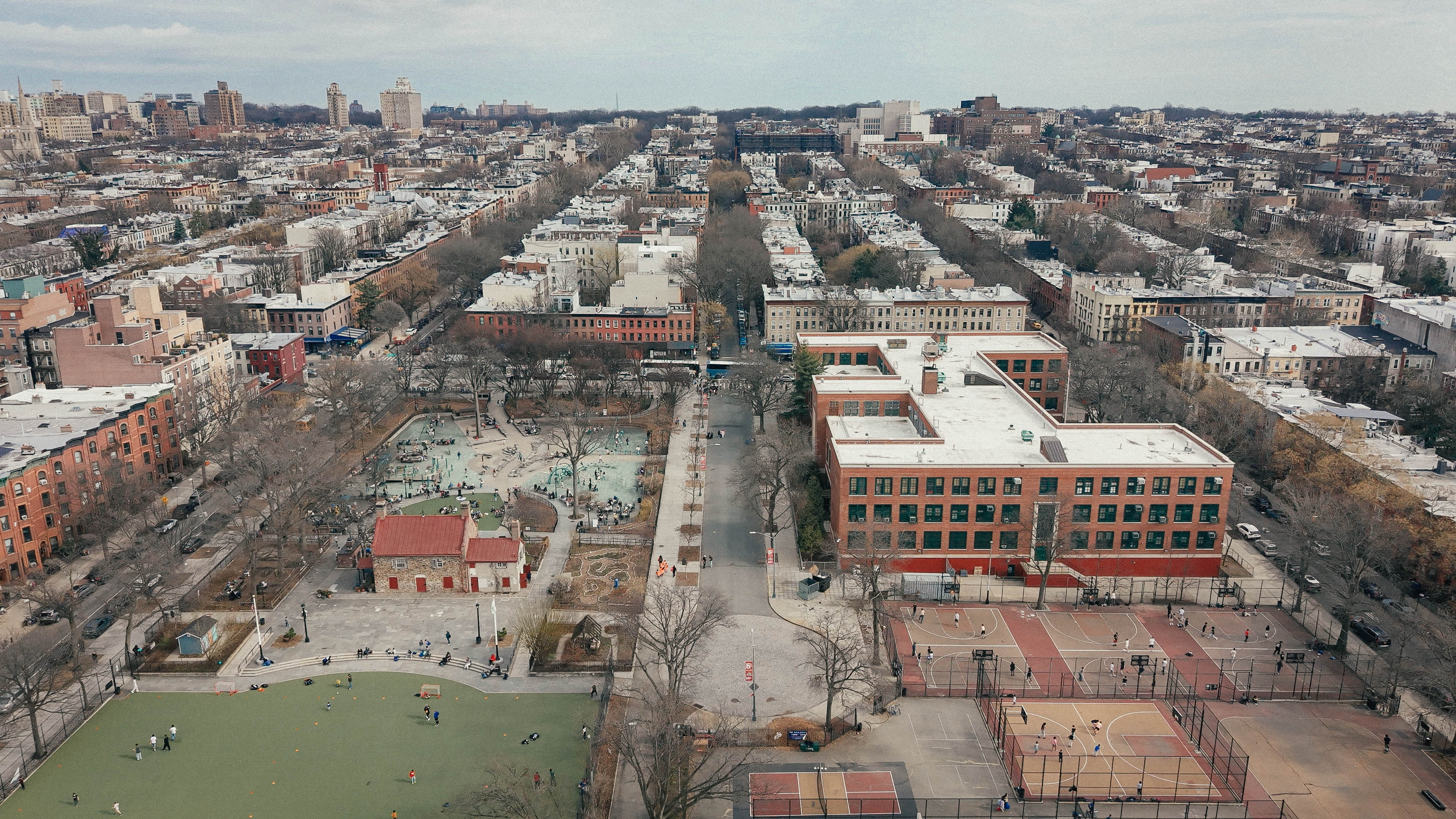
THE BIG PICTURE: WHAT WE KNOW
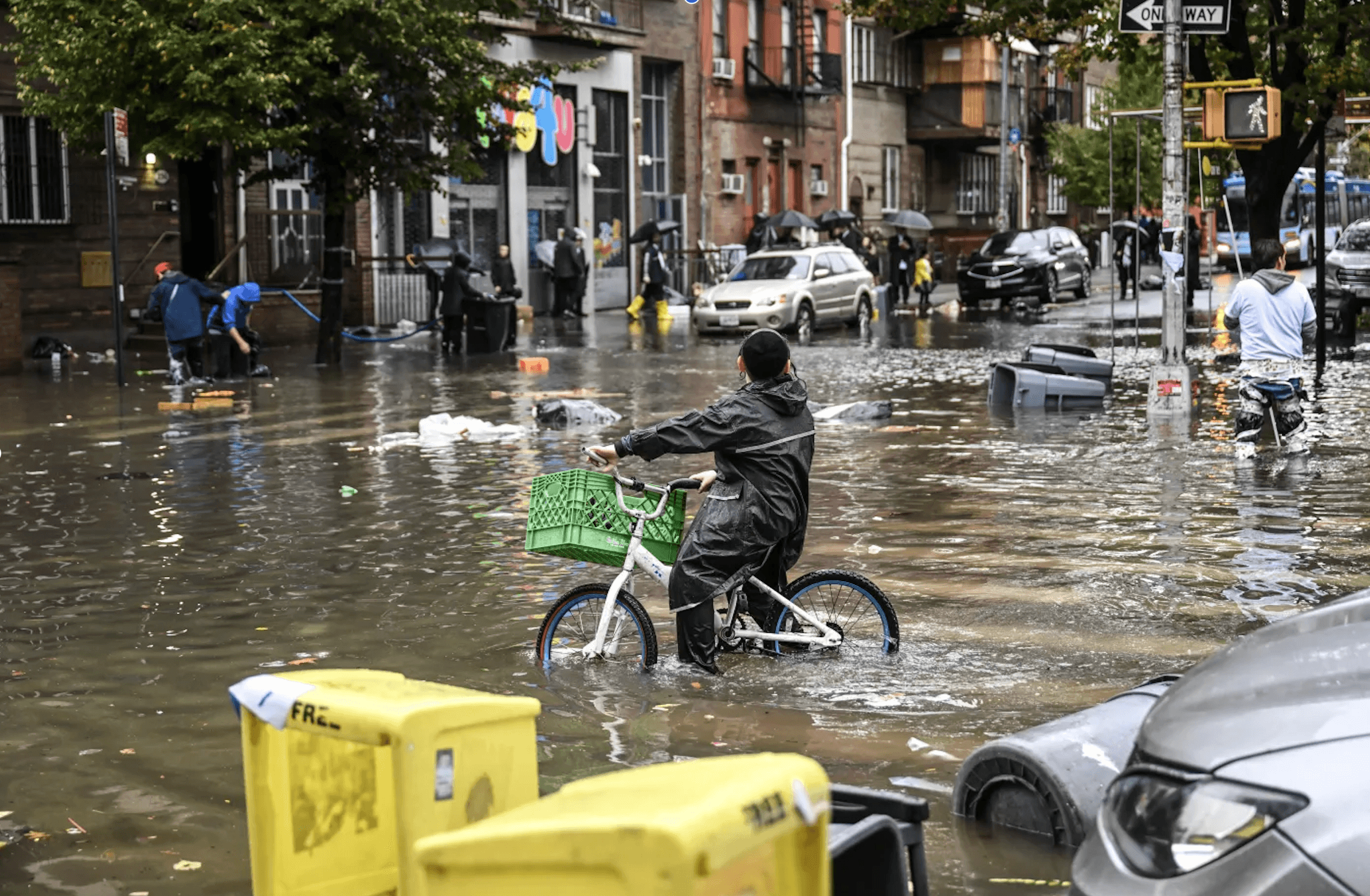
New York faces increased stormwater flooding, sewer backup, and combined sewer overflow events due to more frequent and intense rainstorms that overwhelm the City’s aging sewer infrastructure.
Current city-wide mitigation efforts focus mainly on reducing effects after water enters the system – not at the source.
So how do we address stormwater runoff at the source?
THE ANSWER: THE STORMWATER RESILIENT DISTRICT
A Stormwater Resilient District is a neighborhood, or part of a neighborhood, defined by city sewer infrastructure that feeds a given combined sewer outfall — for example, Owls Head-007.
It is an area in which strategic, distributed stormwater interventions have potential to combat local flooding, reduce combined sewer overflow, and in turn influence the way the larger sewershed manages extreme rain events.
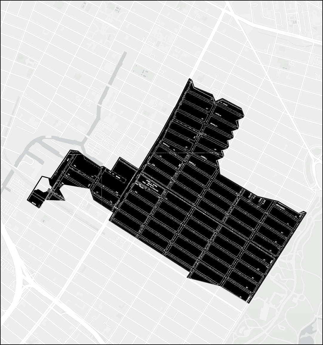
The catchment area that feeds the Owls Head-007 combined sewer outfall stretches from the park to the canal. Here, the fine white lines trace the under-street city sewer infrastructure. The outfall itself empties into the canal at the end of 2nd Avenue.
THE OUTFALL: OWLS HEAD-007
Owls Head–007 is a combined sewer outfall fed by a catchment area – or sub-sewershed – comprising a substantial portion of Park Slope.
It is home to nearly 21,000 people across more than 3,100 properties. And it is just one of 32 similar sub-sewersheds that make up the larger Owls Head sewershed, served by the Owls Head Wastewater Treatment Plant in Bay Ridge.
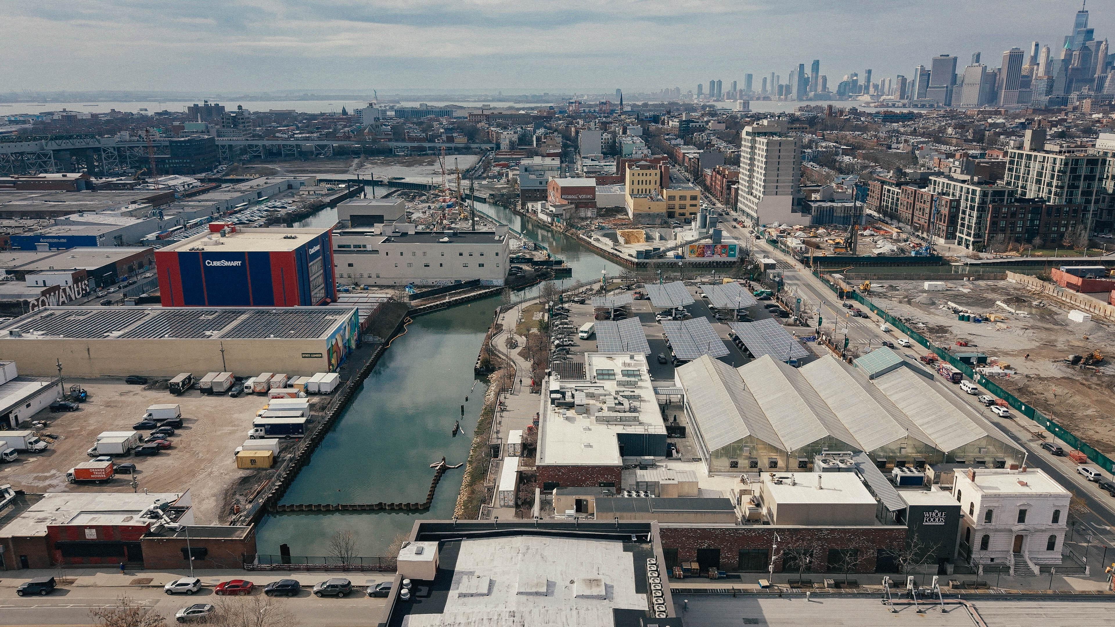
Owls Head is in turn just one of 11 sewersheds that overflow into the Gowanus Canal.
The catchment area for Owls Head-007 is a perfect candidate to become the city’s first Stormwater Resilient District.
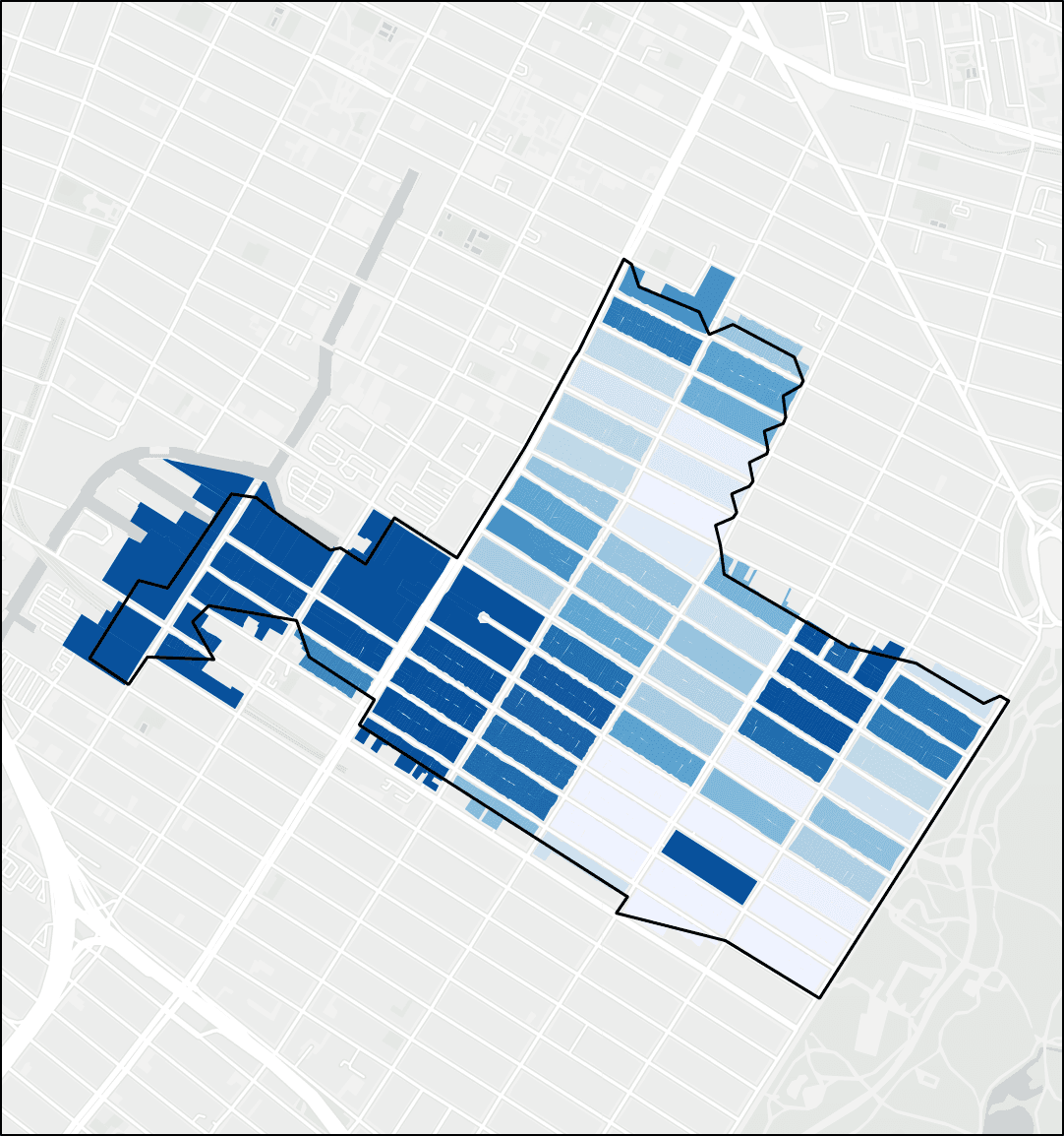
COMPOUND FLOOD EXPOSURE IN THE OWLS HEAD-007 RESILIENT DISTRICT BY BLOCK
The darker the blue, the greater the exposure i.e. the greater the chance of flooding. Note how the average exposure increases moving downhill from the park towards the canal.
What a difference topography makes!
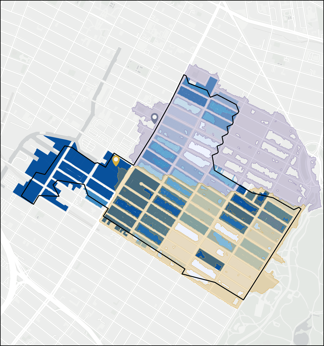
STORMWATER CONTRIBUTING AREAS IN THE OWLS HEAD-007 RESILIENT DISTRICT
Not all the stormwater that feeds a flood-prone area falls directly within it. This view shows the larger contributing areas for two low points along 4th avenue, one in lavender and one in orange.
Imagine all that stormwater rushing down through the neighborhood and inundating those two points!
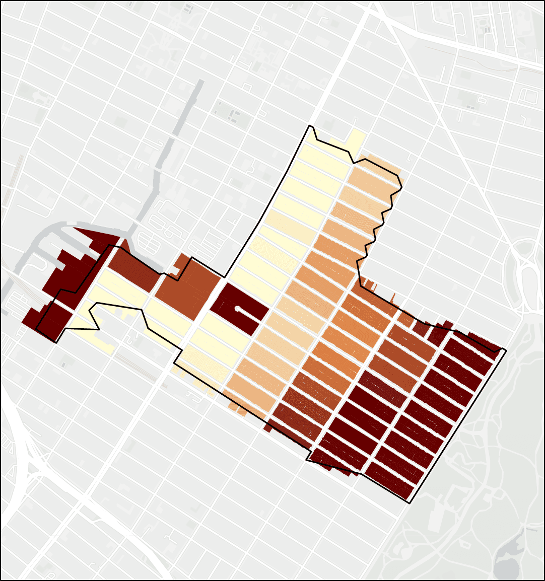
INFILTRATION POTENTIAL IN THE OWLS HEAD-007 RESILIENT DISTRICT BY BLOCK
The darker the orange, the greater the potential i.e. the better-drained the soil and the stronger the case for at-the-source interventions.
Look at the (almost entirely) inverse relationship between upland infiltration potential shown in degrees of orange and lowland compound flood exposure shown in degrees of blue, above.
WE’RE IN THIS TOGETHER: COLLECTIVE ACTION, COLLECTIVE BENEFIT
Because the sites where targeted interventions have the greatest potential to make a difference are not necessarily the same as the sites that experience flooding most acutely, transforming a sub-sewershed area like Owls Head-007 into a Stormwater Resilient District calls on neighbors at opposite ends of the area to recognize their shared stake in the resilient future of our city — and to organize, block by block.
Organized neighbors are able to...
- Build common cause, momentum, and a shared will to action
- Identify and site appropriate, property-scale intervention strategies with the understanding that they may fall disproportionately in certain areas
- Pursue bundled projects that maximize impact
- Advocate collectively for public investment
THE RESILIENT FUTURE: A VISION FOR OWLS HEAD-007 AND BEYOND
The Stormwater Resilient District offers a viable — and scalable — pathway to reduce local flood exposure and pressure on city infrastructure, moving us towards net-zero combined sewer overflow.
Imagine a resilient future in which we can interact safely and freely with a clean canal!